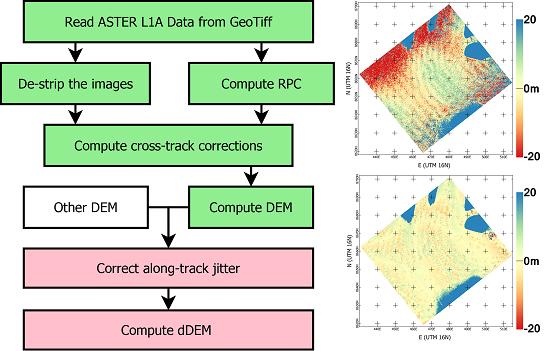
Correcting ASTER DEMs using the MMASTER Pipeline
Digital Elevation Models
My other research projects are dependent on recently available higher-resolution data, both for inputs into transient calibration models and inspecting seasonal signals. The polar-orbit satellite ICESat-2, launched in 2018, can provide this data for recent years, but historic data is not as accurate, nor as spatially- and temporally-dense. Digital elevation models (DEMs) are used to represent the earth's topography - or, in the case of glaciology, the surface of the ice. NASA's Terra satellite, launched in 1999, houses an instrument called ASTER, which takes high-resolution images of earth on multiple wavelengths. These images are stitched together to create global DEMs beginning in the year 2000.

Correcting Historical DEMs
However, the resolution of ASTER DEMs is not high enough for them to be particularly useful in comparing glacier elevations. A series of algorithms, called the MMASTER Pipeline, has been developed to remove instrument jitter and co-register the ASTER DEMs with existing DEMs. Using this tool, I am working to stitch together a series of DEMs that will provide a better picture of glacier elevation evolution during a critical time in Greenland's ice history, when large-scale retreat began in the late 1990s. These corrected DEMs will be available for public use when they are complete, and they will be important inputs to calibrate my adjoint model and in comparing seasonal changes in glacier thickness.